3665 Thorpe DriveMason, TN 38049
Mortgage Calculator
Monthly Payment (Est.)
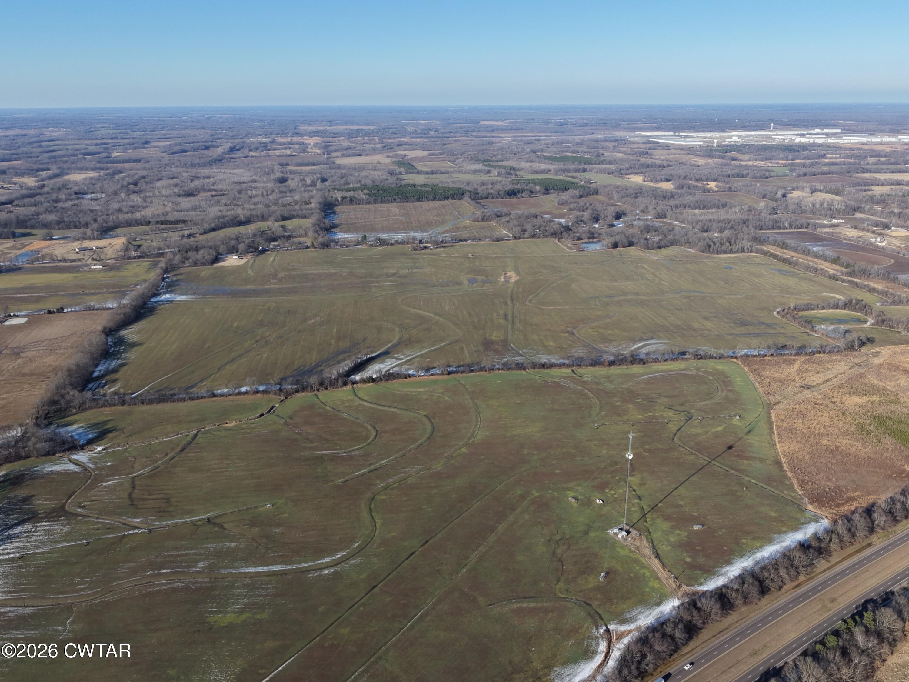
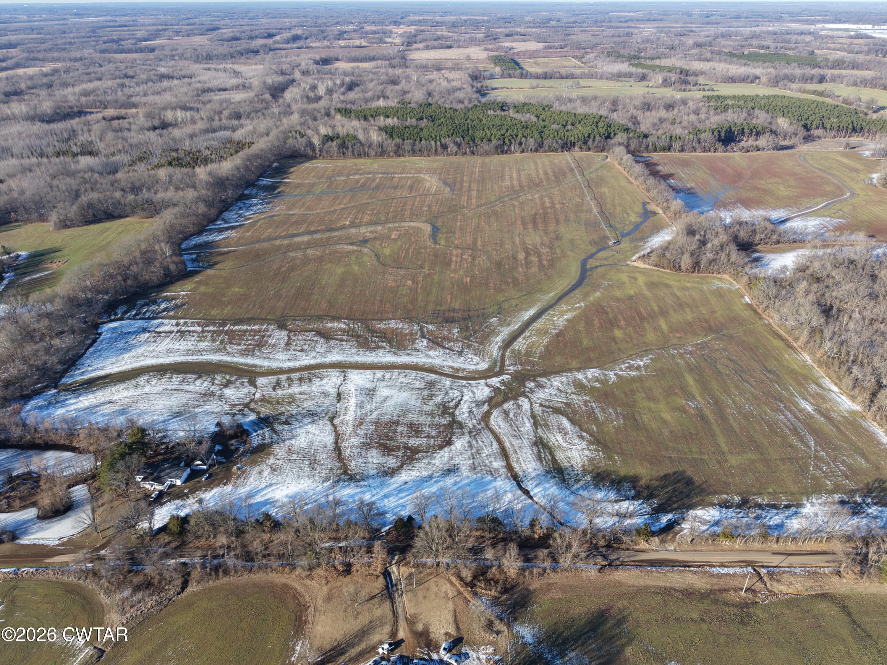
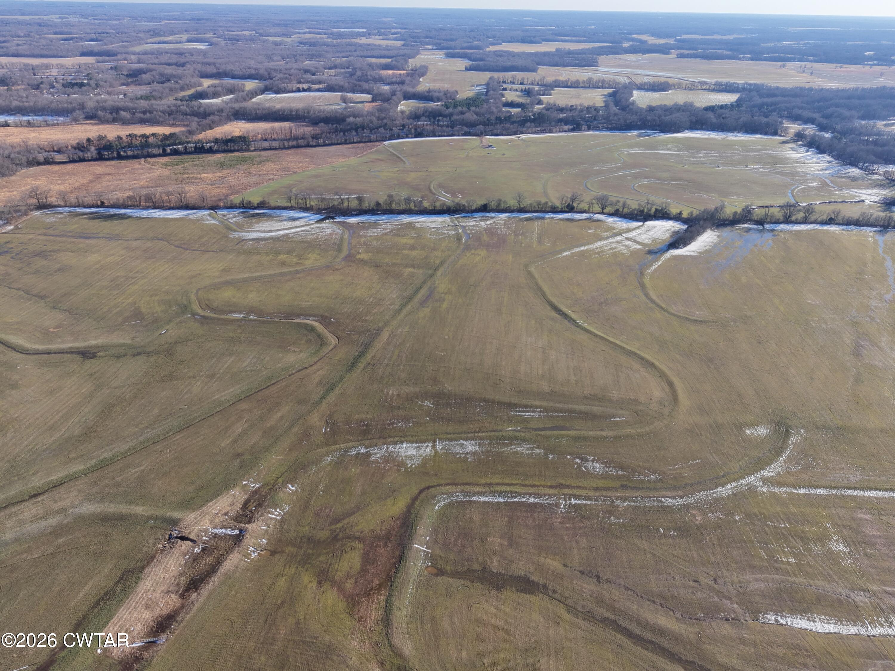
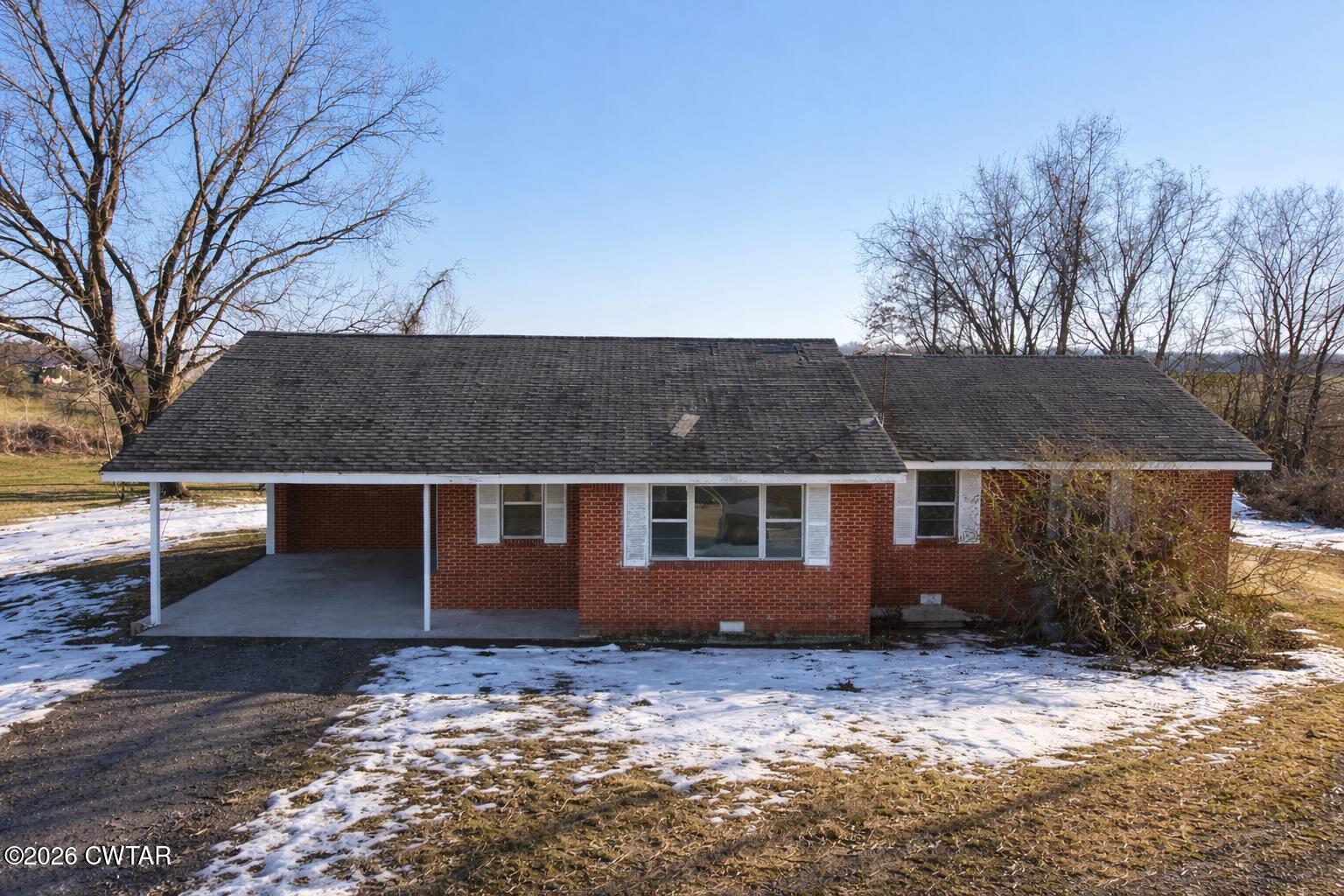
$23,268Large contiguous agricultural tract located on Thorpe Drive in Fayette County, Tennessee, consisting of approximately 341.5 acres under Parcel ID 013-028.00 per county records. The property is conveyed as one continuous tract and includes a 1,562± square foot single-family residence built circa 1963, positioned on an established improvement site within the larger acreage. The land offers a strong mix of productive rotational tillable ground totaling approximately 299.5 acres, along with wooded acreage, non-productive ground, and an improved homesite. Gently rolling topography supports efficient agricultural use while also providing flexibility for estate ownership, recreational use, or long-term land investment. Interior field divisions and access paths are present within the tract. Per county parcel mapping, the property is an irregularly shaped single tract. The southern boundary runs generally east to west and lies north of the major highway corridor, with no interstate frontage included. The eastern boundary extends generally north to south and reaches toward Thorpe Drive, providing paved road access. The northern boundary follows a series of angled and stepped parcel lines adjoining wooded and agricultural tracts, while the western boundary adjoins additional agricultural land and follows a mostly north to south orientation with minor deviations. The residence is located toward the central-southern portion of the property. Utilities include public electric, individual water, individual gas, and individual sewer or septic. The property is located in FEMA Flood Zone X, indicating minimal flood risk. County records reflect agricultural and household unit land use, and no detached parcels or outparcels are included. Conveniently located within close proximity to Blue Oval City, this property presents an opportunity to acquire a large-scale Fayette County tract positioned near one of West Tennessee's most significant economic growth areas while maintaining rural privacy and agricultural productivity. Buyer or buyer's agent to verify all acreage, boundary lines, zoning, utilities, land use suitability, and intended use. Exact boundary lines and corner locations are subject to the recorded deed and or a buyer-obtained survey.
| 3 weeks ago | Listing first seen on site | |
| 3 weeks ago | Listing updated with changes from the MLS® |
Listing information is provided by Participants of the Central West Tennessee Association of Realtors MLS. IDX information is provided exclusively for personal, non-commercial use, and may not be used for any purpose other than to identify prospective properties consumers may be interested in purchasing. Information is deemed reliable but not guaranteed. Copyright 2026, Central West Tennessee Association of Realtors MLS.
Last checked 2026-03-01 11:29 PM UTC
Did you know? You can invite friends and family to your search. They can join your search, rate and discuss listings with you.